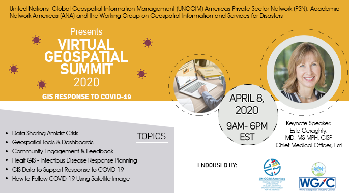
Cumbre geoespacial virtual 2020
Evento
Información del evento
Fecha
8 Abr 2020, 05:00 - 14:00Tipo de evento
Reuniones y seminarios técnicos
Documentos de la reunión
-
Virtual GIS Summit on COVID-19 eventbrite
Virtual Geospatial Summit 2020
Agenda
Listado de recursos - Presentaciones, Grabaciones, Sitios Web etc.
Reporte
Opening Keynote: Health GIS Infectious disease response planning
Opening Keynote: Introduction to Caribbean Geoportal
Geospatial information in the ECLAC COVID 19 Observatory, Alvaro Monett
GIS DATA TO SUPPORT RESPONSE TO COVID 19: THE ITALIAN CASE, Maria Brovelli
GIS Response to COVID 19, Javier Teran Castro
COVID 19 RESPONSE USING IMAGERY AND GEOSPATIAL DATA, Alicia Williams-Kumar Navulur
COVID 19 Response, Adam Reedy, Milquiades Walther - Rodriguez
UN COVID-19 Data Hub aims, Daniel Eshetie
Geospatial Tools and Dashboards, Josiah Burkett
GIS Response to COVID 19, Community Engagement & Feedback, Valrie Grant - Sheree Cameron
Community Engagement and Feedback: Reaching all Communities, Alan Mills
COVID 19 Geospatial Products, Remote Assessments and GeoDashboard, Francesco Stompanato
COVID 19 - statistics and geospatial, Martin Brady
SNIT - SDI Chile, Macarena Pérez García
Data sharing amidst the crisis, Geovisor to support crisis management, Sandra Moreno
Leveraging a Health SDI for COVID 19 Pandemic Response, Ivan DeLoatch