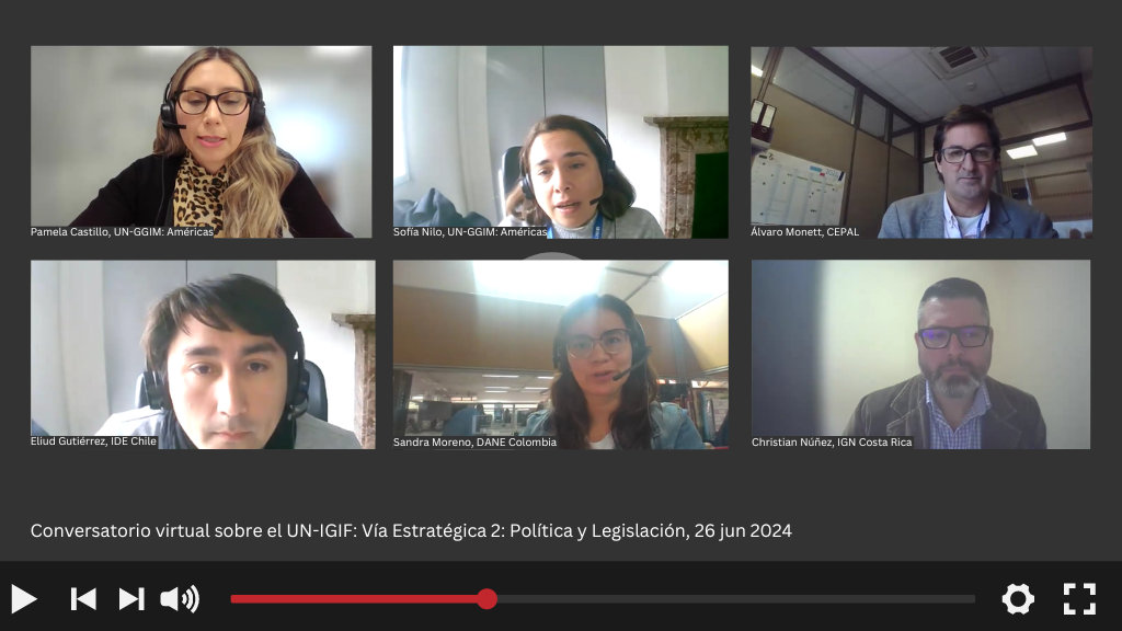
Second Virtual Webinar - Conversations on the Integrated Geospatial Information Framework (UN-IGIF): Strategic Pathway 2: Policy and Legal
Work area(s)
Topic(s)
Teaser
The Integrated Geospatial Information Framework (UN-IGIF) was developed in collaboration between the United Nations and the World Bank, with the purpose of providing guidance to countries in developing and strengthening their national and subnational arrangements on geospatial information management and related infrastructure.
Event information
Date
26 Jun 2024, 08:00 - 09:00Event type
Organized by the Working Group on the Integrated Geospatial Information Framework (UN-IGIF) of UN-GGIM: Americas.
The Working Group on the Integrated Geospatial Information Framework (UN-IGIF) of the Regional Committee of the United Nations on Global Geospatial Information Management for the Americas (UN-GGIM: Americas) was created with the aim of enabling the countries of the region to advance in the implementation of this Framework. In this regard, the group has designed a series of consultations aimed at Member States to assess the status of UN-IGIF implementation in the Americas. These consultations have highlighted the importance of delving into tangible experiences in each of the nine strategic pathways of the Framework: Governance; Policy and Legal Framework; Finance; Data; Innovation; Standards; Partnerships; Capacity and Education; and Communication and Engagement.
These virtual webinar aim to equip the geospatial community at all levels with the necessary knowledge to understand the benefits of implementing the UN-IGIF, from theory to practical examples in each strategic pathway. They target all sectors, including academia, public sector, private sector, non-profit organizations, research groups, and regional initiatives related to geospatial information management.
The main objectives are:
- To disseminate the Integrated Geospatial Information Framework (UN-IGIF) from a practical and real perspective.
- To provide countries with the opportunity to learn about concrete experiences in the implementation of each strategic pathway of UN-IGIF.
- To encourage countries to initiate the UN-IGIF implementation process by addressing available materials, as well as implementation guides and success stories.
- To address and resolve doubts within a space for capacity building and shared experiences.
Programme of work
Welcome remarks
Sofía Nilo, President UN-GGIM: Americas
Introduction to Strategic Pathway 2: Policy and Legal
Presentation(s)
Implementing the Strategic Path of Governance and Institutions: Chile´s success story
Presentation(s)
Round of country interventions
▪ Sandra Moreno, Geostatistics Division, DANE, Colombia
▪ Christian Núñez, Department of Geography and Geomatics, Instituto Geográfico Nacional (IGN), Costa Rica
Related content
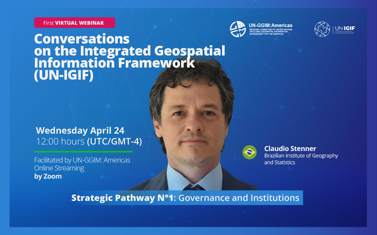
First Virtual Webinar - Conversations on the Integrated Geospatial Information Framework (UN-IGIF): Strategic Pathway 1: Governance and Institutions
The United Nations Integrated Geospatial Information Framework (UN-IGIF) serves as a foundational roadmap for enhancing geospatial information management globally. Its primary goal is to aid…
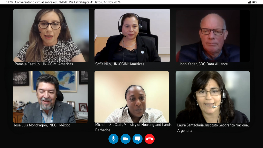
Third Virtual Webinar - Conversations on the Integrated Geospatial Information Framework (UN-IGIF): Strategic Pathway 4: Data
The Integrated Geospatial Information Framework (UN-IGIF) was developed in collaboration between the United Nations and the World Bank, with the purpose of providing guidance to countries in…
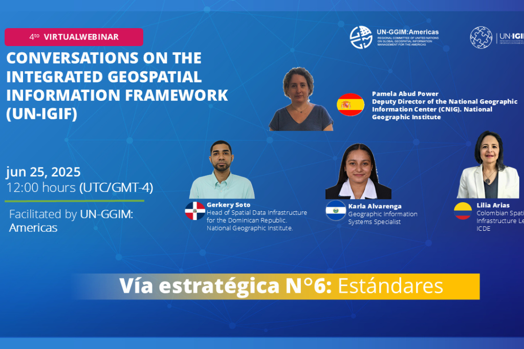
Fourth Virtual Webinar - Conversations on the Integrated Geospatial Information Framework (UN-IGIF): Strategic Pathway 6: Standards/Norms
The Integrated Geospatial Information Framework (UN-IGIF) was developed in collaboration between the United Nations and the World Bank, with the purpose of providing guidance to countries in…
Attachment(s)
Organizing institution
United Nations Regional Committee on Global Geospatial Information Management for the Americas
- http://www.un-ggim-americas.org/
- telephone
Economic Commission for Latin America and the Caribbean (ECLAC)
- https://www.cepal.org
- 56 222100000